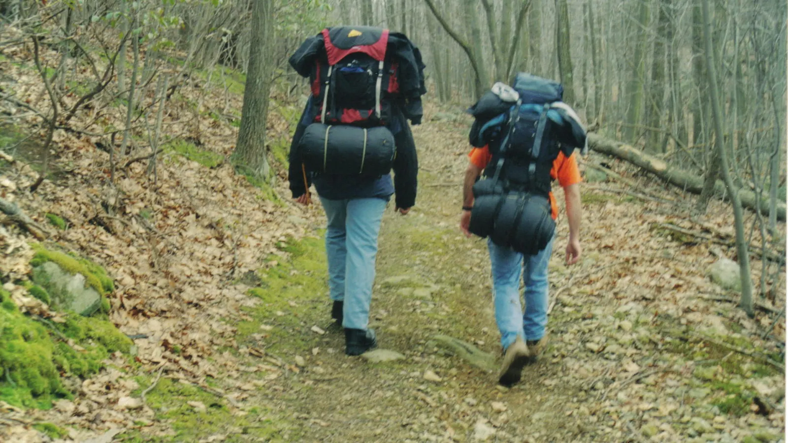
Outdoor & adventure
Hiking
Hiking has almost no barrier to entry, which is both its great virtue and the reason mountain rescue teams are busy. The gap between a long walk and a hill day is not fitness or equipment: it is that the weather changes, the ground is harder than it looks, and the light goes. This page is built around closing that gap honestly, without pretending a checklist makes a route safe.
Also known as hillwalking, rambling, walking, fell walking, trekking.
Hiking is walking, extended: further, over rougher ground, usually away from places where help is close. The skill is not in the walking, which everybody can do. It is in judging distance and time, reading weather and ground, and knowing when to turn round.
It divides less sharply than most activities, but the divisions matter for planning. A lowland walk on paths and tracks needs a route and sensible clothing. A hill or fell day adds exposure, weather that changes fast and ground that is genuinely tiring. Mountain days add navigation in poor visibility and consequences that escalate quickly. Long-distance walking — a named trail over days — is a logistics and endurance problem rather than a technical one. Backpacking carries the accommodation too, which changes everything about pack weight.
What makes hiking unusual among outdoor pursuits is how little it asks at the start and how quickly the demands rise. Nobody needs a lesson to walk up a hill, and that is exactly why people find themselves on one in trainers in poor weather with two hours of daylight left. The honest framing is not that hiking is dangerous — it is that the same activity spans a very wide range of consequence, and the transition between the ends of it is not signposted.
- What actually catches people out
- Time, weather and daylightAlmost never fitness, and almost never the distance on paper.
- The two things to fix first
- Footwear and a waterproof
- Plan around
- Ascent, not just distanceClimbing is what makes a walk slow and tiring; the flat mileage misleads.
- Always tell someone
- Your route and your return time
Getting better
What comes after the beginner stage.
Places
Where this happens, and what each place asks of you.
Equipment
All 3What the kit does, and how the pieces work together.
- Boots and crampons: the compatibility rulesWhy boots carry a stiffness rating, why crampons carry a matching one, and how to avoid the most expensive mistake a beginner makes in this sport.3 min read
- Layering, and why the system matters more than the garmentsWhat each layer is for, why the ability to change them quickly matters more than how many you own, and the two mistakes that make an expensive system useless.3 min read
- What goes in the pack on a winter mountain dayThe items that earn their weight, the ones people leave behind and regret, and why the pack is packed in a particular order.3 min read
Starting out
The first session, the first purchase, and what not to buy yet.
Technique
One skill at a time, explained properly.
Calculators
The arithmetic, done for you, with the working shown.
Choices
The decisions people get stuck on, settled.
- Scrambling vs hikingScrambling is hillwalking that uses its hands, and the moves are not the difference. The difference is consequence: the same slip that bruises you on a path can kill you on a ridge.
- Running vs hikingRunning is an hour from your door on a weekday. Hiking is a day out that needs travel and daylight. The exercise is almost incidental to that difference, and it is the difference that decides which one becomes a habit.
Culture and history
How the community works, and where it came from.
Step 1: Waymarked lowland circuits
Five to ten kilometres on paths, in ordinary clothing plus a waterproof.
You will know it worked when: Range, pace and whether you actually enjoy it.
Step 2: Longer lowland routes with a map
Fifteen kilometres or so, navigating rather than following signs.
You will know it worked when: Basic map reading under no pressure.
Step 3: Your first hill day
A recognised route on a popular hill, in good weather, with plenty of daylight. Popular is a feature: there will be people about.
You will know it worked when: Ascent, exposure and hill weather, with a wide margin.
Step 4: Navigation in poor visibility
Learn it deliberately, ideally on a course or with a club, rather than discovering it in cloud.
You will know it worked when: The skill that turns a bad day into an inconvenience.
Step 5: Multi-day walking
A named trail with accommodation, then backpacking with a tent. Consecutive days are a different kind of tired.
You will know it worked when: Endurance and logistics.
Step 6: Winter, scrambling, or a long project
Winter hillwalking is a separate discipline needing ice axe and crampon skills taught properly. Scrambling moves towards climbing. Munro bagging or a national trail is a project measured in years.
You will know it worked when: A direction, and a reason to keep going out.
Step 1: Start on waymarked lowland routes
Marked trails, visitor-centre routes and published circular walks. They remove the navigation problem entirely while you find out how far you actually want to walk, which is almost never the distance you imagined.
You will know it worked when: A realistic sense of your own range.
Step 2: Work out your pace on real ground
Time a few walks and note the distance and the ascent. Everybody walks at a different speed and published time estimates assume an average that may not be yours. Knowing your own figure is what makes every later plan reliable.
You will know it worked when: You can predict how long a route will take you, specifically.
Step 3: Buy the waterproof before the boots
Getting cold and wet is what turns a walk unpleasant and, on a hill, what turns it dangerous. A genuinely waterproof jacket with taped seams and a hood that fits matters more than footwear on a British hill, and much more than anything else in the pack.
You will know it worked when: Bad weather stops ending the day.
Step 4: Learn to read a paper map before you rely on a phone
Contours, grid references, scale and what the symbols mean. A phone is an excellent navigation tool and it is a single point of failure with a battery, a screen you cannot see in rain, and no signal where you most need it. Carry both; be able to use the paper one.
You will know it worked when: You are not dependent on a device.
Step 5: Add ascent gradually, not distance
A flat 15km and a hilly 8km are not comparable, and the hilly one is usually harder. Progress by adding climbing rather than by adding miles, and the step up to hill days stops being a shock.
You will know it worked when: Genuine hill fitness rather than flat mileage.
Step 6: Walk with a group before you walk alone in the hills
Rambling and hillwalking clubs are numerous, cheap and welcoming, and they teach pacing, navigation and the culture by osmosis. Solo hill walking is a legitimate and lovely thing to do; it is not the way to learn.
You will know it worked when: Skills learned from people, and routes you would not have found.
Step 7: Always leave word
Where you are going, your route, and when you expect to be back. If nobody knows you are missing, nobody is looking. This costs a text message and is the single most useful thing you can do.
You will know it worked when: A search starts hours earlier if it needs to.
Hiking kit is sold by weight of catalogue and the genuinely necessary list is short. The ordering here is by what fails first when the weather turns.
In order of what matters:
- A waterproof jacket — Taped seams, a hood that fits over a hat and turns with your head, and long enough to cover your backside. Breathability is a genuine spectrum and the marketing around it is worse than the products. This is the item to spend on.
- Footwear that suits the ground — Trail shoes for paths and dry ground; boots with ankle support and a stiffer sole for rough hill ground and heavy packs. Fit is everything — a boot that rubs at 3km will end the day at 10km. Buy in the afternoon when your feet have swollen, wear the socks you will walk in, and walk them in before a long day.
- Layers, and not cotton — A wicking base layer, an insulating mid layer, a shell. Cotton holds water against the skin and stays cold, which is why "cotton kills" is a cliché in outdoor circles — it is overstated for a lowland stroll and entirely fair on a wet, windy hill.
- A pack that fits — 20–30 litres for a day. The hip belt should carry most of the weight; if the straps are digging into your shoulders, the pack is either too big, badly adjusted, or worn too loose.
- Map and compass — A 1:25,000 map for detail or 1:50,000 for wider ground, in a waterproof case, and a baseplate compass. Both work in rain, in the dark, and at 4% battery.
- Food and water — More food than you think and something you will actually eat when cold and tired. Two litres of water is a reasonable default and depends heavily on weather and effort.
- A head torch — Carried on every hill walk regardless of the plan, because the plan is what goes wrong. Weighs nothing.
- Warm layer and emergency shelter — An insulated jacket that lives in the pack and comes out when you stop, and a group shelter or survival bag. Stopping is when you get cold, and stopping is what happens when something goes wrong.
- Walking poles — Genuinely useful on descent, where they take substantial load off the knees, and on rough or steep ground for balance. Adjustable, and worth trying before dismissing.
What you can skip: almost all of the technical clothing sold for mountaineering, gaiters unless you are in deep mud or snow, and anything described as a system. A first aid kit is worth carrying and worth knowing how to use — the second half is the part people skip.
The specific things that go wrong, in roughly the order they do:
- Running out of daylight — The commonest reason walks become incidents. It is a planning problem, and a head torch turns it from an emergency into an inconvenience.
- Getting cold and wet — Hypothermia does not need extreme cold — wind and wet at a few degrees above freezing is enough, especially once you stop moving. It degrades judgement before it degrades the body, which is what makes it dangerous rather than merely unpleasant.
- Navigation failure in poor visibility — Hill fog removes every feature you were navigating by. This is where map and compass competence stops being a nice idea, and where a phone with a dying battery becomes frightening rather than annoying.
- Slips and ankle injuries on descent — Most injuries happen going down, when legs are tired and the ground is wet. Poles help, slowing down helps more.
- Water crossings — Streams rise fast in rain and moving water is far stronger than it looks. A crossing that was ankle-deep in the morning can be impassable in the afternoon; the answer is to turn back rather than commit.
- Being separated from the group — Agree regrouping points, keep the back marker in sight, and never let somebody drop off the back alone.
- If it does go wrong — In the UK, 999 or 112 and ask for the police, then mountain rescue. The emergency SMS service must be registered in advance to work, which is worth doing now rather than needing later. Stay put if you are lost and it is safe to; a stationary person is far easier to find.
The commonest way a walk goes wrong is that it takes far longer than expected, and the light goes. That is a planning failure rather than a fitness failure, and it is entirely preventable.
Distance on its own is a poor predictor because ascent dominates. Climbing is slow and tiring in a way flat mileage is not, and a route with a lot of it will take substantially longer than its distance suggests. The traditional approach, associated with the Victorian mountaineer William Naismith, is to estimate a base walking speed and then add a fixed amount of time for every unit of height gained. It is a rule of thumb rather than a formula: it takes no account of ground conditions, wind, pack weight, group size or how tired you are by the afternoon, and it consistently underestimates for most people on rough ground.
The reliable version is empirical. Time your own walks, note distance and ascent, and build up a picture of what *you* do. That figure — your figure, on real ground, with a pack — is worth more than any published estimate, and it is the input the hiking time estimator on this site asks for rather than assuming.
Planning habits that prevent most problems:
- Work backwards from sunset — Note the time it gets dark, subtract your estimated walking time, add a substantial margin, and that is your latest sensible start. In British winter this is a much tighter constraint than people expect.
- Identify escape routes before you go — Points where you can cut the walk short and get down or back. Knowing they exist changes the decision when weather closes in from a crisis into a choice.
- Set a turnaround time — Decide before you start what time you will turn back regardless of how close the summit is. Then honour it. The summit is not going anywhere.
- Check the mountain forecast, not the town one — Conditions on a summit differ enormously from the valley below: colder, far windier, and often in cloud when the valley is clear. Dedicated mountain weather services exist for this.
- Plan for the slowest person — A group moves at the pace of its slowest member and gets colder at every stop waiting. Plan the route for them, not for the average.
- Take the map you can actually use — 1:25,000 shows field boundaries and detail, which helps in complex lowland ground. 1:50,000 covers more ground and is easier to read at a glance on open hill.
- Ascentalso: height gain
- Total height climbed over a route, added up across every uphill section. The number that predicts how hard a walk will be, far better than distance.
- Contour
- A line on a map joining points of equal height. Closely spaced contours mean steep ground; the interval is stated in the map key.
- Grid reference
- A coordinate from the map grid identifying a location. Six figures gives 100m precision, which is the standard for describing a position to mountain rescue.
- Bearing
- A direction in degrees taken from a map and followed on a compass. The core navigation skill when visibility fails.
- Right of way
- A legally protected route across land — footpath, bridleway, restricted byway or byway — shown on Ordnance Survey maps in England and Wales.
- Access land
- Mapped open country and registered common land in England and Wales where there is a right to roam on foot beyond the path network.
- Bothy
- A basic unlocked shelter, mostly in Scotland and northern England, maintained by volunteers and free to use. Has its own strong etiquette.
- Trig point
- A concrete triangulation pillar used for historic mapping surveys. Not always the true summit, and a common collecting target in its own right.
- Cairn
- A pile of stones marking a route or summit. Adding to established cairns is fine; building new ones is discouraged, because they mislead people in poor visibility.
- Munro
- A Scottish mountain over 3,000 feet. There are hundreds, and completing them all is a recognised long-term project called Munro bagging.
- Scrambling
- Ground steep enough to need hands as well as feet. Graded from 1 to 3, and grade 3 approaches rock climbing in consequence if not in technique.
- Exposure
- How much of a drop is beside you and how much it matters. A path can be technically easy and seriously exposed.
- Escape route
- A planned way to cut a walk short and descend safely. Identified before setting off, not during.
- Backpacking
- Multi-day walking carrying camping equipment, as distinct from staying in accommodation along the way.
Access to the countryside is a legal question with different answers in each part of the UK, and it is worth knowing which regime you are in rather than assuming.
- England and Wales — A network of public rights of way — footpaths, bridleways, restricted byways and byways — plus mapped access land where a broader right to roam applies on foot. Off those, you are relying on the landowner’s tolerance rather than a right. Rights of way are shown on Ordnance Survey maps and are legally protected routes rather than suggestions.
- Scotland — A broad statutory right of responsible access over most land and inland water, established by the Land Reform (Scotland) Act 2003 and set out in detail in the Scottish Outdoor Access Code. The right comes with responsibilities and it is genuinely wider than the English and Welsh position rather than merely more relaxed.
- Northern Ireland — A much more limited network of public rights of way than the rest of the UK, and far more dependence on permissive access and landowner agreement. Do not assume the English position applies.
- The Countryside Code — Not law in itself but the standard expectation: leave gates as you find them, keep dogs under effective control and on a lead around livestock and ground-nesting birds, take litter home, and do not block gateways when parking.
- Leave no trace — Take everything out including food waste, which does not vanish and does attract animals. Stay on the path where one exists, because braiding and widening is the visible damage walkers do. Bury or pack out human waste well away from water.
- Wild camping — Broadly permitted in Scotland under the access rights, with byelaw exceptions in some areas. In England and Wales it generally requires the landowner’s permission, with a long-standing tolerated practice on parts of Dartmoor whose legal basis has been litigated in recent years and is worth checking rather than assuming.
Almost everything that goes wrong on a day walk announces itself an hour or two before it becomes a problem, and almost all of it is recoverable at that point. The value of knowing the early signs is that the decision is still yours to make: on a hillside, the difference between an inconvenience and an incident is usually how early somebody was willing to change the plan.
What follows is ordered roughly by how often it happens rather than by how serious it is. The most common problems on British hills are not dramatic.
- You are much further behind than you expected — The commonest fault by a distance, and it is almost always ascent rather than distance. Check the time against your escape routes rather than against the summit, and make the decision now while you still have both. A turnaround time set at breakfast and honoured at two in the afternoon is the single most useful habit in hill walking.
- A hot spot on your heel — Stop and deal with it immediately, which nobody wants to do and everybody regrets not doing. A hot spot is a blister that has not formed yet and tape over it now costs five minutes; a burst blister at mile eight costs the rest of the day and possibly the next one. The underlying cause is friction from movement, so the fix is usually sock, lacing or grit rather than the boot.
- You are cold and it is not getting better — Eat, add a layer, and get moving or get out of the wind — in that order, and before you feel you need to. Cold on a hill is progressive: getting cold makes you slower, being slower makes you colder, and the point at which somebody stops making sensible decisions arrives before they notice. Watch it in other people rather than in yourself, because that is where it is visible.
- The path has disappeared — Stop walking. The instinct is to carry on and pick it up further along, and that is how a small navigation error becomes a large one. Work out where you actually are from the ground and the map, not from where you meant to be. If you cannot, going back to the last point you were certain of is almost always faster than any alternative.
- Cloud has come down and you can see fifty metres — The ground you can see stops being enough to navigate by, and everything now depends on compass and distance rather than on features. This is why the skill is worth having before you need it. Handrails — a wall, a stream, an edge — are far easier to follow than a bearing across open ground, and going down into cloud is safer than going along a ridge in it.
- Everything you are wearing is wet — Waterproofs stop working long before they leak: they wet out, so the face fabric soaks and the garment stops breathing, and the water you are then wearing is mostly your own. Nothing on the hill will fix it. What matters is that the layer next to your skin is not cotton and that you have one dry insulating layer that has stayed in the pack.
- The descent is worse than the climb — Expected, and not a sign of anything wrong. Descending loads knees and quadriceps in a way climbing does not, and most trips and falls happen going down and tired. Poles help genuinely here, shorter steps help more, and planning a descent on a path rather than on steep grass helps most.
- Somebody in the group cannot continue — Get them out of the wind and into a layer before doing anything else, because it will take longer than you think to arrange whatever comes next and they will cool while you do. Then decide honestly whether the group can get them down. Calling for help early and standing down is unremarkable; calling late is the problem.
- The stream you crossed this morning is now much bigger — Rain upstream, and it can rise fast on steep ground long after the rain where you are has stopped. A crossing that was straightforward at ten may not be at four, and moving water is far stronger than it looks. Going a long way round is the answer more often than people accept.
- You are exhausted and it is only lunchtime — Usually food and water rather than fitness. Hill walking burns through both faster than flat walking and people under-eat because they are not hungry when they are working hard. Eat before you want to, drink before you are thirsty, and reassess in half an hour rather than immediately.
- Planning by distance and ignoring ascent — The commonest planning error. A hilly 8km can take longer than a flat 15km, and the flat number is the one people quote to themselves.
- Starting too late — Particularly in winter, when there may be seven usable hours of light. Work backwards from sunset and add a margin.
- Relying entirely on a phone — Batteries die in cold, screens are unusable in heavy rain, and signal fails exactly where the ground is hardest. Carry a phone and carry a map.
- Wearing cotton — It holds water and stays cold. Fine on a summer lowland walk, genuinely dangerous on a wet, windy hill.
- New boots on a long walk — Blisters end more days than weather does. Walk boots in on short outings first, and treat a hot spot immediately rather than at the next stop.
- Checking the valley forecast — Summit conditions are colder, far windier and often in cloud when the valley is clear. Use a mountain forecast.
- Not telling anybody — If nobody knows your route, a search has nowhere to start. One text message.
- Carrying too much — The other failure mode. A 15kg day pack makes an enjoyable walk exhausting, and most of what is in it will not be used. Carry the weather protection and the emergency kit and leave the rest.
- Pushing on because of the summit — Summit fever is a real and well-documented decision failure. Set a turnaround time before you start, and treat it as binding rather than advisory.
The overview sets out the divisions that matter for *planning a day* — lowland, hill, mountain, long-distance, backpacking. This section answers the other question people ask, which is what hiking leads to and which of those things are genuinely different activities rather than harder walks. The answer is unusually clean: hiking is the trunk that most British outdoor pursuits branch off, and several of the branches have their own pages here because they stop being walking.
- Long-distance walking — the same activity, scaled — A named trail over days, staying in accommodation or camping. Nothing about the movement changes; what changes is logistics, resupply, foot care and the fact that you cannot have an off day and go home. It stays on this page because the skills are the ones above with endurance added, not new ones. Walking a named trail *end to end continuously* is a further step and has its own page — at that point resupply, money and attrition become the whole problem and it stops being a walking question.
- Backpacking and wild camping — carrying the accommodation — The point at which pack weight becomes the organising constraint of the trip rather than a detail of it. The camping half — where you may sleep, how, and the law that governs it, which differs by nation — is a subject in its own right and has its own page.
- Scrambling — where the hands come in — The genuine boundary, and the one most worth understanding. Scrambling is where the ground steepens enough that you use your hands and a slip stops being a stumble. It has its own page because the consequence, the decision-making and the kit all change, and because the transition from a hard hill day into easy scrambling is the least signposted step in British hillwalking.
- Fastpacking — the same route, running, with a night out — Multi-day self-supported movement at running pace, which makes it a kit-and-weight problem before it is a fitness one. Separate page, and the honest distinction from long-distance walking is speed and what that forces you to leave behind.
- Trail running — the same ground, faster and lighter — Different sport, same terrain, and a very common progression for people who already walk. It has its own page.
- Ski touring — the winter version — Walking uphill on skis and descending on them, in terrain and conditions that add avalanche judgement to everything else. Separate page, separate risk model, and not a winter extension of hiking however much the uphill resembles it.
- Mountaineering — where technical equipment becomes necessary — Rope, axe and crampons as normal rather than exceptional. Beyond where this page reaches, and the sensible route into it is through scrambling and winter skills rather than directly.
- Walking with an objective — a whole family of them — Geocaching, trigpointing, birdwatching, foraging and mycology all use hiking as the means rather than the end, and each has its own page. They are worth knowing about because they are the commonest reason somebody who does not think of themselves as a hiker ends up walking twelve miles.
Hill culture in Britain is quietly friendly and has firm norms. You greet people you pass on the hill, which surprises visitors from countries where you do not. You stop for anybody who looks like they are in difficulty. Nobody is impressed by pace, and nobody minds a slow group — but standing in a gateway or blocking a farm track with a car will make you genuinely unpopular, and reasonably so.
Mountain rescue in the UK is almost entirely volunteer and free at the point of use, funded by donation. That is a remarkable arrangement and it depends on people not treating it as a safety net that makes preparation optional. Calling them out is the right thing to do when you need it, and preparing so you do not is the other half of the bargain.
There is a long-running argument about honeypot routes: a handful of famous hills absorb enormous numbers of walkers, with real erosion, parking and litter consequences, while comparable hills nearby are empty. Spreading out is better for the ground and usually better for the day, and route guides that only ever name the famous ones are part of the problem.
Walking for pleasure is a comparatively modern idea. For most of history walking long distances was what you did because you had to, and mountains were regarded as obstacles or worse. The shift is usually traced to the Romantic period, when writers began describing wild landscape as something to seek out rather than endure — an attitude change that preceded the activity.
British hillwalking became a mass pursuit through industrial cities: rambling clubs formed in the nineteenth century, largely among urban working people wanting access to the countryside on their day off. That collided with private ownership of the moors, and the resulting access campaigns are a genuine part of the sport’s history. The 1932 Kinder Scout mass trespass is the best-known episode and its causal weight is argued about — it was one action among decades of campaigning, and crediting it alone with the eventual creation of national parks and the Countryside and Rights of Way Act 2000 flattens a much longer story.
The post-war settlement produced the national parks, the long-distance national trails, and eventually the statutory right to roam over mapped access land in England and Wales in 2000, and the broader Scottish access rights in 2003. Those are recent, hard-won and unevenly distributed across the UK, which is why the access section on this page has to be split by country rather than answered once.
- How long will a walk take me?
- Longer than the distance suggests, because ascent dominates. The traditional approach is a base walking speed plus a fixed addition for height gained, which is a useful starting point and consistently optimistic on rough ground, in wind, with a pack, or late in the day. The reliable method is to time your own walks and note the distance and ascent until you know your own figures — which is what the hiking time estimator on this site asks for rather than assuming an average that may not be yours.
- Do I need proper boots?
- Not for lowland paths in dry weather — trail shoes or trainers are fine and lighter. Boots earn their place on rough hill ground, in wet conditions and under a heavy pack, where ankle support and a stiffer sole genuinely help. Whatever you buy, fit matters more than the specification: try them on in the afternoon with walking socks, and walk them in before a long day. Blisters end more walks than weather does.
- Is it safe to hike alone?
- Many people do it for years without incident, and it is one of the great pleasures of the hobby. It is not the way to learn. Alone, there is nobody to help if you turn an ankle, nobody to check your navigation, and nobody to notice you have stopped making sense as you get cold. If you do walk alone, stay well within your competence, leave your route and return time with someone, carry a way to call for help, and be more conservative about weather and turnaround times than you would be in a group.
- Can I use my phone instead of a map?
- As well as, not instead of. Phone mapping is genuinely excellent — it tells you where you are, which a paper map cannot — and it is a single point of failure with a battery that drains fast in cold, a screen that is hard to use in rain, and no signal in the places that matter most. Carry a paper map and compass and be able to use them. Carry a power bank too.
- Where am I allowed to walk?
- It depends which country you are in. England and Wales have a network of public rights of way plus mapped access land where you may roam on foot; off those you are relying on tolerance. Scotland has a much broader statutory right of responsible access over most land and inland water. Northern Ireland has a far more limited rights of way network and depends heavily on permissive access. Ordnance Survey maps show rights of way and access land, and it is worth checking rather than assuming the position where you live applies elsewhere.
- What do I do if I get lost?
- Stop before you compound it. Work out where you last knew your position and whether you can retrace to it. If visibility is poor and you cannot establish where you are, and you are safe where you are, staying put is often better than wandering — a stationary person is much easier to find. If you need help, 999 or 112 and ask for the police, then mountain rescue, and give a grid reference if you can. Register for the emergency SMS service now, because it only works if you registered in advance.
Where people actually do this
Area character, access and how to arrive. No routes and no distances — see the page for why.
Within this activity
Disciplines, variants and techniques that sit inside it.
Disciplines
- Long-distance walking — Walking a named trail over days or weeks, carrying or forwarding your kit.
- Peak bagging — Working through a defined list of summits — Munros, Wainwrights, county tops.
If you like this
Each of these is here for a stated reason, not because it is also a hobby.
Easier way in
- Orienteering — The same terrain and the same maps at whatever pace you like, with no course, no clock and no timing card to download.
- Running — The same terrain and the same fresh air at a pace that does not load the joints, and a much gentler way back after injury.
- Ski touring — The same terrain and the same navigation without the avalanche layer, the four-figure kit bill or the requirement to have a party. Where most tourers came from.
Cheaper alternative
- Horse riding — For the reader whose honest answer to the cost section is "then not this". Much of what draws people to riding is the countryside at a pace that lets you look at it, and walking delivers that for the price of boots, immediately, with no lesson booked and no animal depending on you.
- Mycology — The same woods at a fraction of the pace and none of the kit — a foray is a very slow walk with a purpose, and it suits people who find hiking’s emphasis on distance beside the point.
Progresses to
- Mountaineering — Where hillwalking runs out: winter conditions, ice axe and crampons, and ground that needs rope. A genuinely different discipline that begins where this one stops.
- Packrafting — Where the boat comes from. Almost everybody who packrafts in Britain arrived as a hillwalker who wanted the water to stop being a detour.
- Scrambling — Scrambling is where competent hill days start using their hands, and it assumes every hillwalking skill underneath it — navigation, pace judgement, and the willingness to turn round, all of which matter more once you are committed to a ridge.
- Thru-hiking — The parent activity and where every skill comes from. What changes is completing a named trail end to end continuously, which turns walking into a logistics problem.
- Trail running — The same ground, covered faster and with far less in the pack. Navigation and route judgement transfer completely; the descending technique does not.
- Wild camping — Carrying the accommodation changes pack weight, planning and the whole rhythm of a walk. The natural next step for anybody who has started wishing the day were longer.
Similar to
- Bikepacking — The same problem — carrying what you need through country you have to navigate — solved at four times the speed and a quarter of the climbing effort. Hikers usually find the planning familiar and the descents alarming.
- Disc golf — A round is a two-hour walk in parkland with something to think about, which is most of what a walk is for.
Goes well with
- Dog training — The reason recall matters, and the setting that tests it — livestock, other walkers and open country are where a trained dog and an untrained one become obviously different animals.
- Fell running — Supplies the ground judgement and hill sense that racing on unmarked open hillside depends on, and recceing a route is walking it first.
- Geocaching — A cache gives a walk a destination, which is the difference between "shall we go out" and "we are going to that hill".
- Navigational rallying — Both run on Ordnance Survey sheets and reward the same fluency with a grid reference, which transfers completely between them.
- Wild swimming — Routes past a tarn or a river make a natural pair, and both reward the same habit of checking conditions rather than assuming them.
- Trigpointing — A collecting game laid over walks you were doing anyway, with a defined national list and a reason to visit hills nobody else bothers with.
Outdoor alternative
- Indoor climbing — The obvious weekend counterpart, and the route by which indoor climbers usually end up outdoors at all — the walk in comes before the route.
Sources for this section
- The Countryside Code (opens in a new tab) — Natural England and Natural Resources Wales · Governing body · read — supports the claim
- Map reading — beginner guides (opens in a new tab) — Ordnance Survey · Institutional · read — supports the claim
- Woodland Trust (opens in a new tab) — Woodland Trust · Institutional · read — supports the claim
Comprehensive
Last reviewed 2026-08-14. Cost, time and difficulty figures on this page are HobbyHQ estimates — see how we work. Something here wrong or out of date? Tell us.